
You are here
UAV Mapping and Aerial Footage
Price:
TBC
Ad Category:
Location:
Seller:
Description
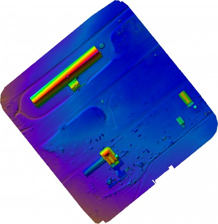
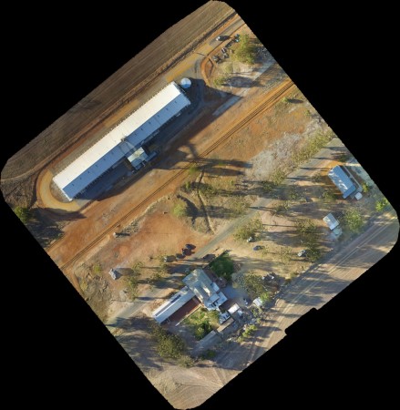
Need high resolution orthophotos and/OR Digital Elevation Models over your tenements or small project areas? Or maybe you need some speccy aerial shots of your drill rigs, office or aerial footage of your operations? We run a small fixed wing and multi rotor platform to provide these services at much lower cost than the surveying mobs.
All mapping surveys tagged with RTK GCP's to give super accurate imagery and elevations.
www.atlasgeo.com.au
Related Ads

Categories
Equipment
83 ads
45 ads
26 ads
65 ads
26 ads
32 ads
- Field Exploration 83
- Field Consumables 45
- Computers and Software 26
- Lab/Metallurgy 65
- Rentals 26
- Other 32

sign up to find gold...

